Thursday, April 30, 2015

Lawrence Homestead

Several of my recent excursions have been to walk through Bruce Trail properties, checking boundaries and other stewardship issues.  The past two days I've walked through a brand new property, the Lawrence Homestead, just north of the village of Kimberley.  It was purchased through last year's fund-raising campaign.

The trail here runs along the escarpment, just below the cliff face, multi-coloured with lichen and a dark line of cedars along the top.

Below the cliff is the talus slope, covered with large mossy boulders that have fallen in the distant past, this one decorated with a line of Maidenhair Fern.

These mossy boulders below the cliff are ideal habitat for the rare Hart's Tongue Fern, which is actually quite plentiful along this stretch of the trail, though it's very rare in North America.

Partly I was looking for property lines, and on the first day took these tools of the trade - a gps, an air photo, a cell phone, and a magnetic survey bar detector.  The cell phone and the air photo were actually most helpful.  The cell phone can show you where you are on Google Maps in relation to the air photo, which has the boundaries marked on it.

Then you start looking for clues on the ground, like this old bit of barbed wire fencing overgrown by the tree.

I found both property lines beneath the looming cliff face above.  And today I took the two volunteer Land Stewards who will keep an eye on this property to walk through it.  Very interesting walk as it turned out.

Along the way some Hepatica, now out in full bloom here.

Further down the slope a nice little stream, tumbling down from one of those five springs that drain out below the Wodehouse Creek watershed.  This property is an old farm, probably abandoned for farming about 40 years ago, so it's still quite open with just young trees coming up in the old fields.

At the bottom of our walk we found the old house foundation as well as the barn foundation.  This sort of evidence of the pioneering farm families in the valley always fascinate me, and I look forward to learning about this particular homestead of the Lawrence family.  As is typical of these homesteads, we saw Periwinkle or Myrtle spreading out around the house, a patch of lilies coming up, and some lilacs, much overgrown.


Wednesday, April 29, 2015

A Walk in the Woods

For nearly two weeks now (apart from last week's cold snap), I've been out exploring and walking.  Each morning now the dog and I walk to the end of the road in our little subdivision, and head into the woods at the back of the neighbour's farm.  I get to watch the magic of May in the woods as nature wakes up, and the dog gets off her leash for a run.

Heading in  on the old tractor trail the only green seems to be the dark mossy boulders; buds aren't even swelling on the maples yet.

But once in the woods and looking around, there's a lot more green than a few days ago, like these leaves of the leeks, bright green in the morning sun.

And overnight it seems, the leaves of the Dogtooth Violets have popped out of the ground, though we haven't spotted a flower yet.  I think these are the single most common leaves on the forest floor in many deciduous woods around here.

The very first tree or shrub leaves to leaf out always seem to be the tiny seedlings of Pin Cherry, glowing red in the sun.

And those mossy boulders or stumps glow bright green when looking into the sun, here with their tiny sporophytes standing up straight.

Further on I discover a suspiciously grass-like plant which is actually a sedge, and it's in flower, another of the very earliest flowering woodland plants.

This is the tiny 'flower' of the Broad-leaved Wood Sedge, about 1/2 an inch tall.

Last year's wood ferns lie on the ground, having stayed green all winter under the snow.

And this year's fiddleheads are ready to uncurl.

The beech leaves which have clung to saplings all winter are still there, and shaking in the breeze.

But the long thin pointed buds of the beech haven't really begun to swell yet.

Meanwhile, Roxie has had a wonderful run through the forest, (she's mostly a nose on four legs), and waits patiently while I take pictures, her breath condensing in the cool morning air.

And looking through the woods as we head home I can see the promise of the next month in the green now popping up all over the forest floor.  The next three weeks are the most magic of the entire year in the woods here, and I will keep reporting on them, as the seasons in the valley unfold!


Tuesday, April 28, 2015

The Lake is Gone!

Sorry to bother you one more time with Wodehouse Karst pictures, and these ones are dull as ditch water!  But I went out today to walk in and see if I could get a picture of the lake half-empty, and lo and behold, the lake was gone!  Here's what it looks like today, 12 days after we paddled across the karst!

This is looking at the main cluster of sinkholes.  You can see there's still a little excess water in the stream, but the lake obviously subsided away very quickly once it started.  The bottom 3-4 feet of those tree trunks would have been in the water.

Looking back up the valley where we paddled from, the entire valley is grey-brown, with fine clay sediment coating all the shrubs.  This was all lake up to the tree line on the far side, and probably 3 feet deep where I'm standing.

But I could her quite a roar from down in the valley, sort of like a waterfall around the corner.  Once I got down there I could see the water just thundering down into the ground under these boulders.  The entire stream here, about 6 feet wide, was just dropping down a hole.  Because of all the willow shrubs, this was the best photo I could get; couldn't avoid my shadow.

And nearby one of the now-dry sinkholes, a crevice in the short wall of limestone that blocks the stream.  This may be one of the 'caves' some people check out.  No water, but I could hear water underneath the rocks.

When I got to the perched pond, now a separate pond instead of part of the lake, it definitely seemed a foot or two lower than I've seen it in the past.

I hunted around and found a tiny stream draining out of the pond, downhill toward the sinkholes below.  There's only about a 6 foot gap between the slope down to the sinkholes, and the pond itself, so it won't take much erosion before we may lose the perched pond entirely!  Another future change to watch for.

This is the final main sinkhole with water pooled over it a few feet deep still.  The camera itself is about at the height the lake was 12 days ago.

And this is just one of the deep sinkholes out in the field where we paddled.  It's about 20 feet deep, and was completely underwater; we paddled right across.  And yes, that's still a snowbank in the distance.  It lasts a long time on the east or north sides of slopes where the drifts accumulated deeply.

Now I promise you, no more posts on Wodehouse Creek, at least not for a while.  I've been busy tramping around Bruce Trail properties and other interesting places I want to share with you.

Monday, April 27, 2015

The Continuing Mystery of Wodehouse Creek

There are two continuing mysteries about Wodehouse Creek that intrigue me, though I don't expect I'll ever really be able to understand them any better than I do now.  I am sure though that I will continue to explore this fascinating area for many years to come.

The first mystery is that the creek seems to get smaller as it goes downstream.  This view is just below the springs, as you head down into the open Wodehouse Marsh.  The stream is about 15' wide, and perhaps a foot deep, even in late summer.

But three roads downstream, it has shrunk to a small creek about 4' wide and a few inches deep.

The other mystery has to do with the springs.  This is one of the main springs, in the fall, where the water just gurgles up out of the ground among those mossy boulders.

A short distance off to the left are other spots where water bubbles up out of the ground.  It's easier to see exactly where after an early December snowfall.

These coalesce to form a beautiful stream tumbling rapidly downhill over the boulders.  The Bruce Trail now passes right beside this cascade.

And at this time of year, here over one of the steeper stretches, it's a foaming white torrent of water.


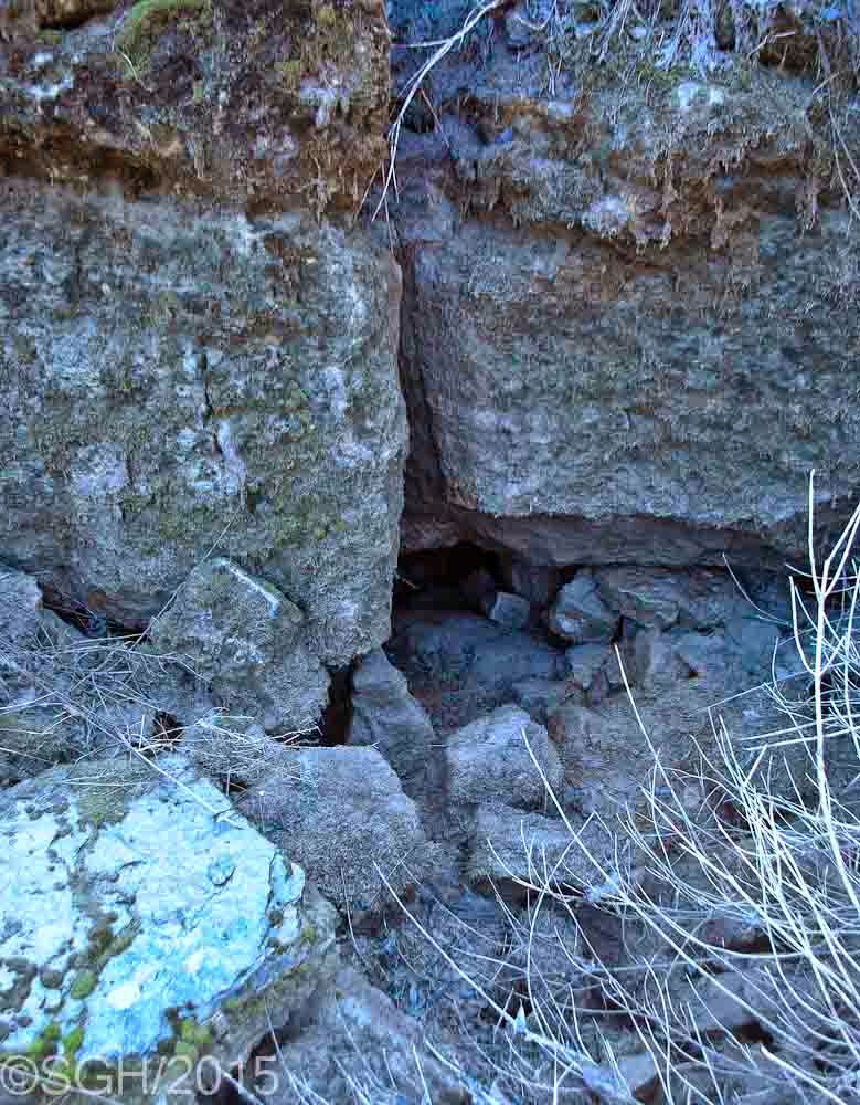
But there are other springs, none as large as that one, but five altogether, strung out along the Niagara Escarpment over 3 or 4 miles, all apparently emerging somehow from the Wodehouse watershed.  This is one of those other small streams much lower down the slopes.


And this is another spring at Talisman Mountain Springs Inn, as it is now known.  This one has been tapped to provide the water supply for the village of Kimberley and a nearby subdivision, so only the overflow plunges out of those two green pipes in the hillside.

The stream gets smaller as it goes downstream, and there are several additional springs along the slope.  I think the mystery might be solved if there are other sinkholes along the channel that we don't know about, taking away some of the water, which in turn feeds these other springs.

This crude map is my attempt to show all this, the creek emerging from the springs in the upper left, flowing east then south, east then south, to the main sinkholes, the perched pond right beside them.  The wiggly stretch of the creek is where we paddled in.  Two arrows show where the overflow during the flood sends water down into the normally much smaller Lower Wodehouse Creek, and over the ephemeral waterfall at Bowles Gully.

If you count the dark streams flowing east that I've highlighted, you'll see that there are five springs altogether.  I've sketched some dashed lines to show my 'theoretical' idea that there are additional sinkholes someplace upstream feeding these springs.

And for anyone interested in the technical details, this diagram is from the excellent book on the 'Geology and Landforms of Grey and Bruce Counties'.  There is actually a ridge all  along the top of the Niagara Escarpment in this area, the Banks Moraine.  It blocks the creek from flowing east and down into the valley.  Behind it the water has gradually eroded down into the glacial material to expose the dolostone cracks, so the water now drains down into those sinkholes.  But the next layer down is shale, which water will not penetrate, so it is forced to flow sideways where it comes out as springs.

Here's one last photo, which was a mystery for me when I took it several winters ago - a slab of ice frozen to several small trees, high above the sinkholes beside the perched pond.  This helped me realize how high the water level gets in the spring; this was the level we paddled at.  This ice resulted from a January thaw which filled the temporary lake which then froze, and the water drained away under all the ice, just leaving still frozen slabs around the edge.

I've really enjoyed putting this series on the karst together, especially because it has forced me to try and express it all clearly, and to find all my relevant photos.  Sorry if it got long and technical in parts, but I'm really pleased with the results!


Sunday, April 26, 2015

Wodehouse Creek Comparison Shots

Before I leave the story of Wodehouse Creek, I want to share with you some of the comparison shots I've taken over the years.  The easiest place to see the creek of course is where it crosses a road, and these shots are all taken from bridges on 5 different roads upstream of the karst.  It's the dramatic difference in water levels that originally got me interested.

This is your first view of the creek, west of the 9th Line, just downstream of the springs.

In early spring it doesn't look too much different, the channel a little wider, and undoubtedly a little deeper.


Moving downstream, this is a summer view from Sideroad 13, where an old barn foundation stood.  It's since been sold and dismantled and rebuilt someplace!

 But that gentle stream turns into a roaring torrent in the early spring.


If you walk in the unused 10th Sideroad, this is the creek in the summer.


And this is the creek in early spring.  It's these dramatic contrasts that got me interested in figuring out what's going on.


And east of the 7th Line, you can hardly find the creek in mid-summer.

 But a couple of weeks ago it would have looked like this.

Finally, at the last road crossing before the karst, Wodehouse Creek is just a small stream hidden among the tall grasses.

Until early spring, when the temporary lake forms, and the whole valley floods.  This is where we went paddling a couple of weeks ago.

These high water levels puzzled me, since they don't come from a lot of spring runoff; they come directly from the springs.  And they're enough to create this large temporary lake.  The view from this sideroad was what first suggested to me that I should hike in to the karst and see what was going on - though it was not until we paddled in that I really understood it.  One more post tomorrow, on 'The Continuing Mystery of Wodehouse Creek'.