If you've been watching the news recently you'll know that a huge flooding crisis is happening in the lower Fraser Valley of B.C. right now. The rural part of Abbotsford is largely located on the drained farmland that was formerly Sumas Lake. Today it's known as Sumas Prairie, and it's one of the best farming area in Canada. It includes the heart of B.C.'s dairy industry.
Here the closed trans-Canada disappears into the floodwaters while the flooded Sumas Prairie extends in the background. This is personal for us, because our daughter and our two grand-children live in Abbotsford. We've been there, we've driven across the farmland and we've hiked with the family along the trails on top of the dykes.
The prairie was drained in the 1920s, a huge pumping system installed and miles and miles of dikes like this one built. We've walked along the top of that dike.
Further north lives have been lost in mudslides, but here it's the farmers who are suffering the loss of life, that of their cattle. I don't know if you've ever spent time on a dairy farm, but dairy farmers generally know their cows by name, Cows have personalities, some are slow, some silly and some just co-operative. Dairy farmers strive to keep their cows comfortable because guess what - comfortable cows produce more milk!
So dairy cows become like members of the family. No wonder farmers are going to extra-ordinary efforts to save their cows, though tragically hundreds are drowning. Dairy cows are bred every year too, because cows need a calf to produce milk. So over the years the quality of a herd steadily increases based on how well the farmers manage things. It represents an investment of decades in many cases.

Here's one of the dike-top trails we've walked along, the canal out-of-sight on the right, the farmland and buildings on the left.


And another dike, the farmland and buildings beyond. It's a pattern that's been in place for 100 years or so and is so familiar most people probably don't even recognize it.

On another nature trail we walked first down the lower level of the canal, surrounded by the trees of the floodplain, but you could see the dike and beyond it farm buildings on the far side.
Along the way we saw several Bald Eagles.
We crossed a bridge and walked back on top of the dike, farms on the left and the sleepy canal on the right. Here we are nearing the end of our walk, still on top of that dike.
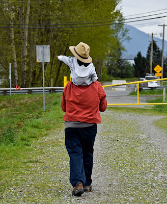
Yes, that's
mois and my grand-daughter on my shoulders (wearing my hat). Yes, this is personal. Spare a thought for the dairy farmers of Abbotsford.
Flood pictures from public news sources.


