Sunday, March 13, 2022

More Signs of Spring

Let's check out the Canada Geese on Lake Eugenia as we continue yesterday's drive.  Tonight is daylight savings time here, and next week the temperature is expected to rise right into the spring range.  It's forecast to be 12°C (53°F) on Wednesday and Thursday!  I can hardly wait.  Those rising temperatures are the real sign of spring.

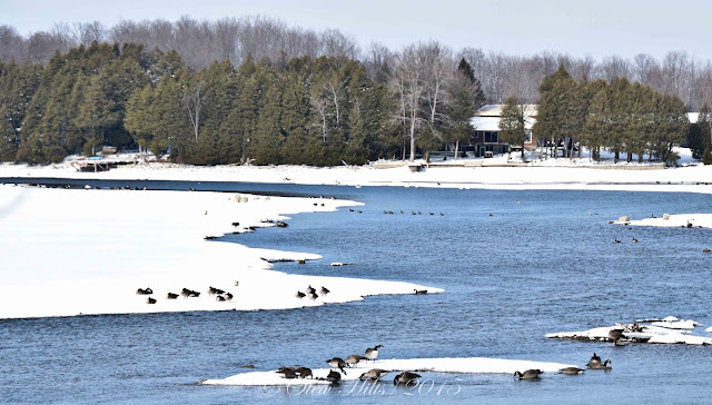
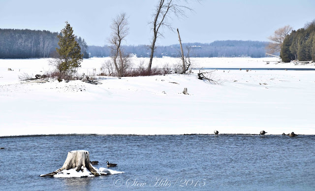
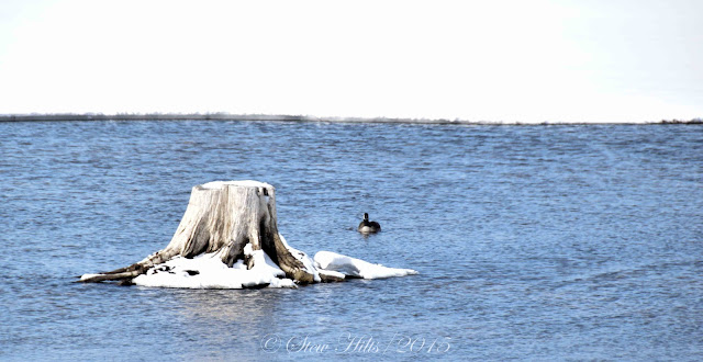
To be honest there weren't many geese and virtually no ducks that we could see on Lake Eugenia, but this did seem to be Canada Geese central for those we saw.  Many of them are paired up, though of course not nesting, while the 'teenage' geese will wait another year to find a mate.  Since most geese stay together as a pair for life, I guess it's worth taking your time to pick a mate.

Are these three pair!  Probably, and what better sign of spring could you ask for?

These too, off by themselves, definitely were.

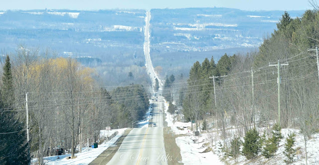
Leaving Eugenia we headed north and down into the valley, Kimberley in the centre of the picture.  From this angle it appears largely forested, but driving around it appears much more open.


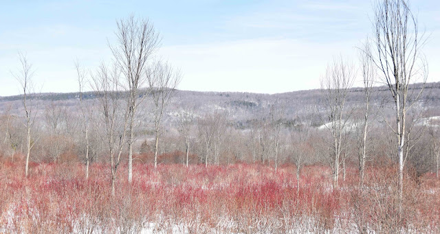
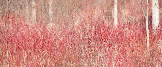
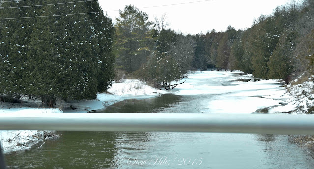
North of the village, through the flat bottomlands of the river, the Red Osier Dogwood were turning bright red, another sign of spring we always watch for.

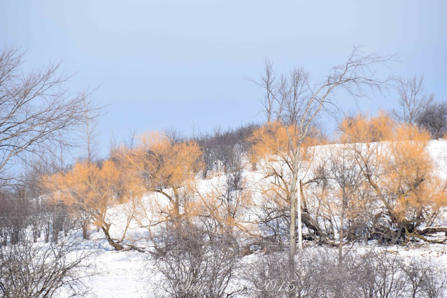
And finally the Black willows were turning an even brighter shade of yellow than normal.  We always watch the dogwood and willows as we drive around this time of year.

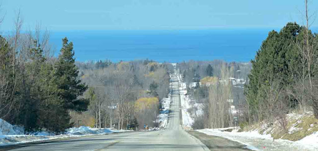
Finally it's over the big Algonquin Shoreline created during the post-glacial period about 11,000 years ago and back down into Meaford.  A thoroughly enjoyable drive and several obvious big signs of spring.

A few other signs of spring are less obvious, but still important:
    - stores are featuring displays of seeds for planting,
    - garden sections in the big box stores are being organized,
    - barbecues have been brought out to front and centre,
    - gardeners at home are scheming and dreaming about their plans for summer,
    - and maybe starting seeds indoors under lights or on a windowsill,
    - nurseries are getting in their stock and preparing for the later spring rush,
    - apple growers are finalizing their plans for the summer,
    - it's March Break this week,
    - churches are planning for Easter services,
    - the streetsweeper is being given a last-minute check (I hope!)
    - if you look closely there's a reddish hue in the trees,
    - buds are starting to swell and preparing to open,
    - the first Sandhill Cranes have returned,
    - owls are nesting in the woods, eagles usually in tall open trees,
    - Tundra Swans are moving north and may be passing overhead soon,
    - And above all it's maple syrup season in the bush and sugar shack!
        My favourite sign of spring!

You can find three posts featuring the Kemble Maple Syrup tour early in April, 2015.


Saturday, March 12, 2022

Signs of Spring

Yesterday we went for a drive down through the valley, stopping at Lake Eugenia.  Along the way signs of spring became more and more obvious.  The big one though is the heat of the sun and the length of daylight, and (though I can't quite believe it), this weekend is daylight savings time here.  That's practically the unofficial start of spring!

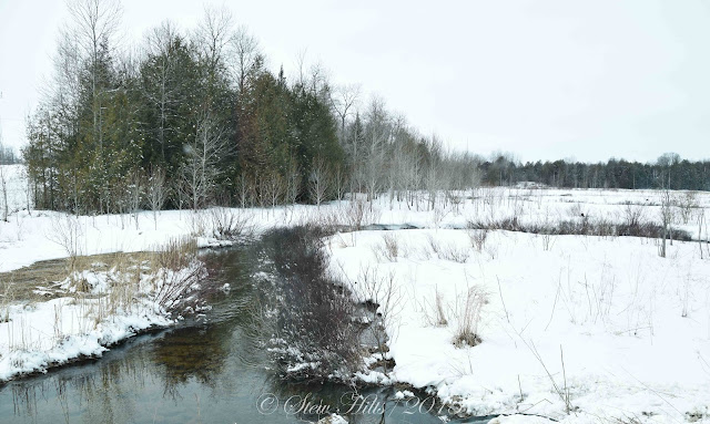
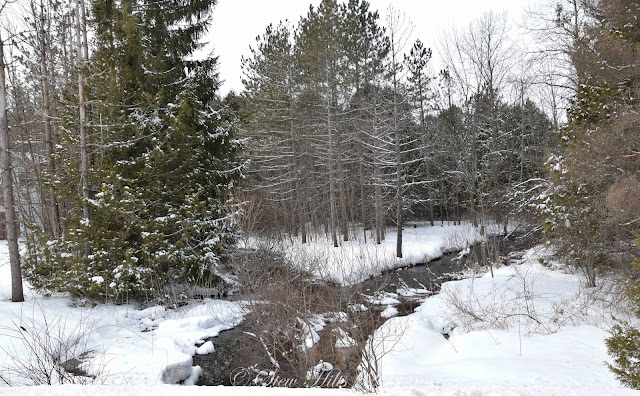
All these pictures are terrible frankly.  Something about the camera settings was way off, and the colour balance just isn't right - but the signs of spring is what we're looking for, and this is the first one, the Bighead River is open after spending much of the winter frozen.

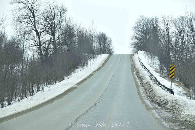
We headed south up the Niagara Escarpment finding all the roads bare and dry, another sign of spring.

We also found all the little creeks were open too.  The first one here is Rocklyn Creek fairly hear its headwaters, draining northwest into the Bighead River.

A little further on and we passed Wodehouse Creek, this one draining southeast through the famous Wodehouse Karst and emerging from five different springs along several miles of the escarpment cliffs.  In a few weeks this will be totally flooded and raging downstream!

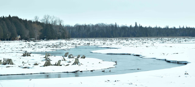
And when we got to Lake Eugenia the former meandering channel of the Beaver River was plain to see in the now exposed lake bottom.  A sea of stumps preserved underwater most of the year, ever since the hydro dam was built in 1914.  Ontario Hydro partially drains this lake in the fall to make room for the expected spring runoff every year.

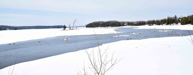
Looking the other direction from the causeway the former river winds through the lake bottom for now, but soon the water will rise and this will look more like a lake.

The lake is pretty well surrounded by cottages now, many converted to year-round homes.

The little scruffy island was still there, as was the old stump.  Tomorrow a visit with the geese.


Wednesday, March 9, 2022

Massasauga Provincial Park Canoe Trip

One more old canoe trip post before I start sharing signs of spring around here!!!  In 2011 we planned a trip around the lakes and inlets of Massasauga Provincial Park, just south of Parry Sound, Ontario.  This is a large area of lakes, islands and forests punctuated by only a few cottages and resorts once you get to the outer areas directly accessible from Georgian Bay.  It's now a provincial park, and today, a decade later is getting far too popular and therefore over-crowded in places.

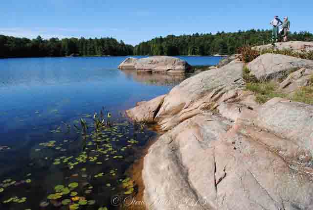
It's more of that granite and pine tree landscape.  This is the first day or exploring on Spider Lake where we landed and had lunch overlooking the lily pads.

The exploring around the corners of the lake took us up some narrow channels!

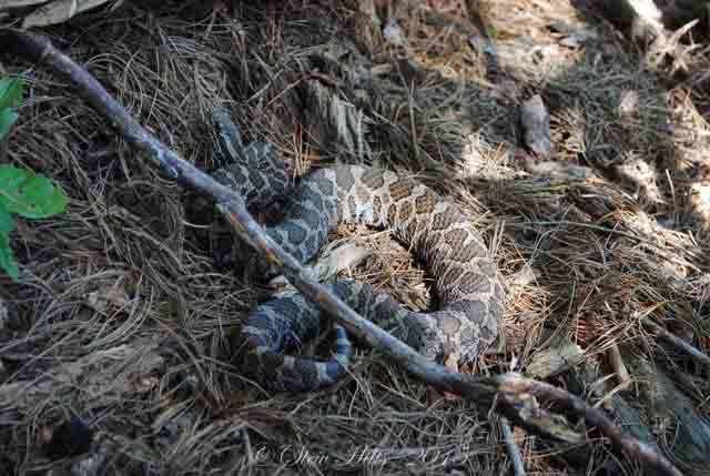
But the highlights of this trip were the wildlife.  I spotted this big old Massasauga Rattlesnake curled up three feet off the path up to our campsite.  I really didn't think I should reach out and move that branch for a better picture!

And this big old Snapping turtle visited our landing spot every day looking for handouts.

And we spotted this beautiful Eastern Milk Snake on the rocks on a later day.

I enjoy evening paddles, often just by myself, as the light sets on the rocks.

It's nice to drift slowly so you can get a picture like this White Water Lily. 

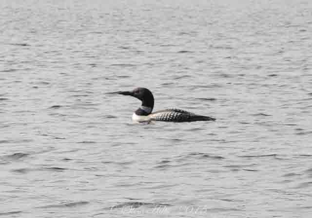
We regularly heard the haunting calls of the Common Loon echoing through the lakes.

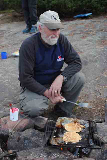
If we were lucky we might get pancakes for breakfast!  Ron is the author of Canoeing Ontario's Rivers and makes terrific flapjacks!.

I got far too many pictures of our last sunset.

But I was alone getting pictures of our last sunrise.

We packed up at the last campsite and headed back to our working lives.


Sunday, March 6, 2022

East French River Canoe Trip

Since it's still winter here (though weather is improving rapidly) and since I already used some of the canoe trip pictures below (sorry for the repetition) to illustrate my hiking video post, I thought I would just go ahead and share a few more details about three of the canoe trips I've been on, the ones I have digital photos for - so this is the first one, on the French River east of Hwy. 69, paddling upstream, back in 2010.  This is part of the famous voyageur canoe route four centuries ago during the heyday of the fur trade.

This is typical northern Ontario canoe country on the Canadian shield, granite rocks, pine trees and beautiful blue waters.

There are designated campsites, usually with 'thunder boxes' (outhouses without the house), so that makes it easy to plan ahead.

Lots of beautiful sunrises and sunsets.  This trip was about a week long.

One early morning riser in the group always volunteers to make the breakfasts, including the all-important coffee!

Time to think,
or just appreciate the solitude!

We usually had four or five canoes on these trips, and the most experienced paddlers made sure to organize the paddling pairs each day to have an experienced person in the stern.  I paddle with a group of former canoe trip leaders, so they know what they're doing; I'm the novice.  They also planned a route for each day (this was in the days of paper maps).

Yes, that's me!

One member of the group brought his single-person pack canoe that year (because we had an uneven number), and I got to try it out for a day.  I enjoyed it so much I later bought my own,  These smaller one-person canoes are fitted with a kayak seat and often paddled with a kayak paddle.  They're sometimes described as 'pack canoes' because they are light enough to pack long distances.
When we came to any rapids above the class 1 swifts we always stopped to assess the white water and pick a safe route through.  I learned an enormous amount about running those rapids!

Here we go!

On this trip there were only a few short portages which made it easy.

I think this was just a stop for lunch when I grabbed a picture - five canoes including the smaller one, and 9 people, including me.

Common Merganzers are a (you guessed it!) common sight on northern rivers.

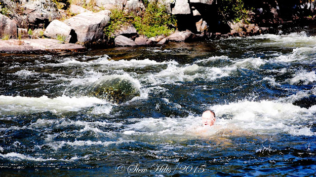
And as long as you're a good experienced swimmer a plunge in the waters below some rapids is fun.

Or a sit on the rocks to ponder life.

And I'll end with these reflections.  I paddled with this wonderful group of friends 10 times over about 20 years.  It was the best thing I ever did for myself.

*************

Spring is springing here, with above freezing temperatures in the forecast all week.

And the Paralympics are on; Canada already has 6 medals on day one.  Did you notice Mollie Jepsen skiing with only one pole on her way to gold?  Her disability consists of missing fingers on one hand; the event is called the standing downhill.


Thursday, March 3, 2022

Long Distance Hiking Trails - AT, CDT, PCT

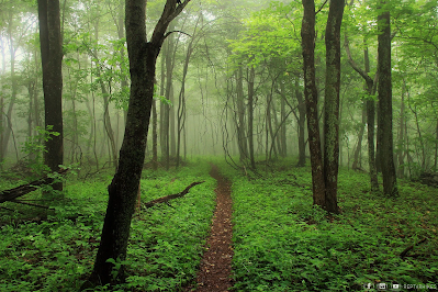
It occurred to me that you might get more out of my post about watching hiking videos if you knew a little about the hiking trails I was referring to, so here's some background info to help your understanding.  The three main long distance trails in the U.S. are the Appalachian Trail, the Continental Divide Trail and the Pacific Crest Trail.  Together these make up the 'Triple Crown' of hiking.

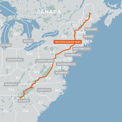
Appalachian Trail (AT) - The AT is about 2200 miles long or 3500 km. for us Canadians, and typically takes about 5-7 months to complete as a thru-hike.  Of course people hike smaller sections of it, or hike into beautiful viewpoints like McAfee's Knob in Virginia, but the hikers I follow are thru-hikers.  

The trail starts on Springer Mountain in Georgia, and ends 14 states later on Mount Katahdin in Maine.  Hikers have to plan how they're going to get both food and water along the way, but towns are frequent enough that they can get off trail every few days to resupply themselves.  And there are plenty of fresh water streams along the way.  There are numerous shelters along the way, but most hikers seem to prefer putting up a tent nearby rather than have the mice families in the shelter for company!


The trail is frequently rainy, but this trail is very popular, and you'll probably never be far away from other hikers.  There are many local hikers in places, given the population of the nearby eastern seaboard.  Thru-hikers often end up travelling in small groups once they find others going at a similar pace, a group known as a 'tramily' or trail family.

Continental Divide Trail (CDT) - The CDT is 3100 miles or nearly 5000 km. and typically takes about 6-8 months to complete.  This trail gets far fewer thru-hikers (or hikers of any kind) than the AT, so you're much more likely to spend some time alone in these miles.
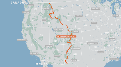
The trail starts in the southwest corner of New Mexico, ends in the northwest corner of Montana, and wanders through 5 states.  This is the only one of the three long-distance trails that is not yet complete, necessitating some road-walking.  It's also the only one of the three that has some alternate route choices; in fact there are quite a few alternate routes, and you'll have to do some serious planning both to start out and along the way.

Food and water sources are a much more serious issue here.  Sources of water are few and far between in places, and in other places consist of cattle-watering troughs.  As one guide wrote: "Be mentally prepared to drink from mud puddles full of cow poop...", along with a few dead mice and lizards floating in the dirty water.  This necessitates having a water purification system with you.  Towns are few and far between too, necessitating much more careful food planning.


The CDT is certainly scenic, but given the alternate routes, scarce water and few towns, it is recommended that you hike the AT or CDT first to gain experience, and you will need advanced navigation skills with a map and compass as well as whatever electronic navigation aids you carry.  Thankfully, there are numerous information sources and excellent annotated maps available online.  There might be some health challenges given the high elevation of some parts of the trail reaching the low Oxygen levels of 14,000 feet.

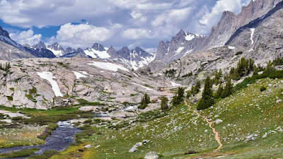
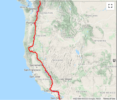
Pacific Crest Trail (PCT) - The PCT is about 2600 miles long or 4300 km.  It generally takes from 5-7 months to complete, with the Sierra Nevada section including several high dangerous mountain passes.  But the scenery is spectacular!

The PCT can be divided into three sections, the southern desert, the central Serra Nevadas, and the rainforests and nearby spectacular mountain peaks  of Oregon and Washington.  In the first of these water sources is the challenge, in the northern section, it may easily be getting late in the season, bringing cold temperatures and snow.

But the middle section, the Sierras, is the most spectacular and the most dangerous.  Hikers must climb high in the mountains to cross several mountain passes where snow conditions make an enormous difference.  They must have ice-axes and bear canisters and know how to do self-rescue on the extremely steep snowfields they have to cross.  Self-rescue means rolling to face the snow and jamming your ice axe in to prevent yourself from sliding 1000 feet plus down the slope!  You must also be prepared to ford raging mountain rivers during the snowmelt.  Under no circumstances should you hike this section alone!


This photo shows hikers inching their way to the 13,000 foot top of Forrester Pass in California.  It actually looks like mountain climbing to me, not just hiking.  One video I watched did feature a description of a hiker losing her footing and starting to slide, luckily self-rescuing herself immediately but having to hang on desperately until rescued properly by two companions.  The PCT is also subject to closures due to forest fires, necessitating detours of some distance sometimes.  

I hope these descriptions give you some sense of what's involved in hiking these trails.  Even though my hiking days are over I find myself fascinated learning about them!

There are of course long-distance trails elsewhere in the world, but there are only two I've watched videos of.

The Camino de Santiago, a famous trail across northern Spain is really a network of pilgrimage pathways as old as 1000 years leading to the shrine of Saint James in the great cathedral of Santiago de compostella.  The most popular route, from the nearest corner of France, is about 500 miles or 800 km. long.  A Canadian from Thunder Bay walked this pilgrimage in 2018 and her videos are all posted on YouTube under the name Samantha Plavins.

The Tour de Mont Blanc is a circular route, and a much more scenic route, in the mountains of Switzerland, France and Austria.  Spectacular scenery but only 110 miles in comparison to the above trails.  It encircles the Mont Blanc massif, a group of 11 peaks over 13000 feet, the highest being Mont Blanc itself, the highest peak in western Europe.

Our own Bruce Trail here in southern Ontario, at about 900 km. in length, is hiked every year by 'End-to-Enders', but rarely as a thru-hike.  It is not really set up well with either shelters or camping sites.

If you want to see what the features of the Appalachian Trail are as an example, I've just watched a terrific video compiled by Taylor the Nahamsha Hiker, entitled 'All the Best Spots', the landmarks of the trail that appealed to her.  Taylor, who runs a gift shop in New Hampshire called 'Nahamsha gifts', is a bright enthusiastic young woman who hiked the AT in 2021 in only 120 days - that's fast!

It's a fun video to watch giving you a hiker's perspective on this trail.

I should say that I never intended to imply that you might be interested in watching well over 100 videos of someone hiking the AT from end to end!  But remember I'm forced to lie in bed awake for an hour or two every night, and I learn a heck of a lot more from these videos than from Facebook!  And also remember that as long as I keep my brain occupied I don't notice the chronic pain.