Sunday, March 6, 2022

East French River Canoe Trip

Since it's still winter here (though weather is improving rapidly) and since I already used some of the canoe trip pictures below (sorry for the repetition) to illustrate my hiking video post, I thought I would just go ahead and share a few more details about three of the canoe trips I've been on, the ones I have digital photos for - so this is the first one, on the French River east of Hwy. 69, paddling upstream, back in 2010.  This is part of the famous voyageur canoe route four centuries ago during the heyday of the fur trade.

This is typical northern Ontario canoe country on the Canadian shield, granite rocks, pine trees and beautiful blue waters.

There are designated campsites, usually with 'thunder boxes' (outhouses without the house), so that makes it easy to plan ahead.

Lots of beautiful sunrises and sunsets.  This trip was about a week long.

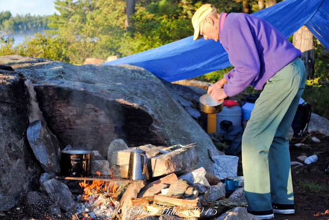
One early morning riser in the group always volunteers to make the breakfasts, including the all-important coffee!

Time to think,
or just appreciate the solitude!

We usually had four or five canoes on these trips, and the most experienced paddlers made sure to organize the paddling pairs each day to have an experienced person in the stern.  I paddle with a group of former canoe trip leaders, so they know what they're doing; I'm the novice.  They also planned a route for each day (this was in the days of paper maps).

Yes, that's me!

One member of the group brought his single-person pack canoe that year (because we had an uneven number), and I got to try it out for a day.  I enjoyed it so much I later bought my own,  These smaller one-person canoes are fitted with a kayak seat and often paddled with a kayak paddle.  They're sometimes described as 'pack canoes' because they are light enough to pack long distances.
When we came to any rapids above the class 1 swifts we always stopped to assess the white water and pick a safe route through.  I learned an enormous amount about running those rapids!

Here we go!

On this trip there were only a few short portages which made it easy.

I think this was just a stop for lunch when I grabbed a picture - five canoes including the smaller one, and 9 people, including me.

Common Merganzers are a (you guessed it!) common sight on northern rivers.

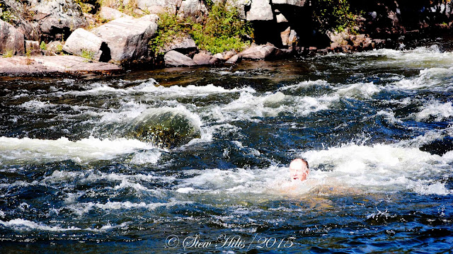
And as long as you're a good experienced swimmer a plunge in the waters below some rapids is fun.

Or a sit on the rocks to ponder life.

And I'll end with these reflections.  I paddled with this wonderful group of friends 10 times over about 20 years.  It was the best thing I ever did for myself.

*************

Spring is springing here, with above freezing temperatures in the forecast all week.

And the Paralympics are on; Canada already has 6 medals on day one.  Did you notice Mollie Jepsen skiing with only one pole on her way to gold?  Her disability consists of missing fingers on one hand; the event is called the standing downhill.


Thursday, March 3, 2022

Long Distance Hiking Trails - AT, CDT, PCT

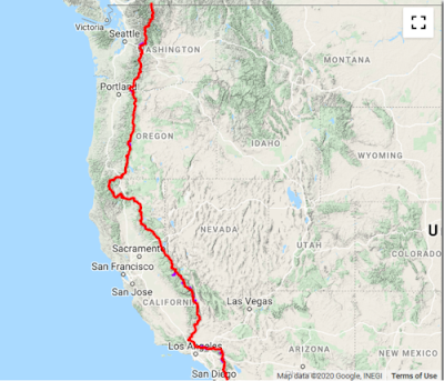
It occurred to me that you might get more out of my post about watching hiking videos if you knew a little about the hiking trails I was referring to, so here's some background info to help your understanding.  The three main long distance trails in the U.S. are the Appalachian Trail, the Continental Divide Trail and the Pacific Crest Trail.  Together these make up the 'Triple Crown' of hiking.

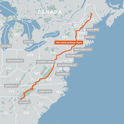
Appalachian Trail (AT) - The AT is about 2200 miles long or 3500 km. for us Canadians, and typically takes about 5-7 months to complete as a thru-hike.  Of course people hike smaller sections of it, or hike into beautiful viewpoints like McAfee's Knob in Virginia, but the hikers I follow are thru-hikers.  

The trail starts on Springer Mountain in Georgia, and ends 14 states later on Mount Katahdin in Maine.  Hikers have to plan how they're going to get both food and water along the way, but towns are frequent enough that they can get off trail every few days to resupply themselves.  And there are plenty of fresh water streams along the way.  There are numerous shelters along the way, but most hikers seem to prefer putting up a tent nearby rather than have the mice families in the shelter for company!


The trail is frequently rainy, but this trail is very popular, and you'll probably never be far away from other hikers.  There are many local hikers in places, given the population of the nearby eastern seaboard.  Thru-hikers often end up travelling in small groups once they find others going at a similar pace, a group known as a 'tramily' or trail family.

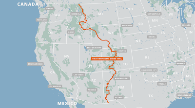
Continental Divide Trail (CDT) - The CDT is 3100 miles or nearly 5000 km. and typically takes about 6-8 months to complete.  This trail gets far fewer thru-hikers (or hikers of any kind) than the AT, so you're much more likely to spend some time alone in these miles.

The trail starts in the southwest corner of New Mexico, ends in the northwest corner of Montana, and wanders through 5 states.  This is the only one of the three long-distance trails that is not yet complete, necessitating some road-walking.  It's also the only one of the three that has some alternate route choices; in fact there are quite a few alternate routes, and you'll have to do some serious planning both to start out and along the way.

Food and water sources are a much more serious issue here.  Sources of water are few and far between in places, and in other places consist of cattle-watering troughs.  As one guide wrote: "Be mentally prepared to drink from mud puddles full of cow poop...", along with a few dead mice and lizards floating in the dirty water.  This necessitates having a water purification system with you.  Towns are few and far between too, necessitating much more careful food planning.


The CDT is certainly scenic, but given the alternate routes, scarce water and few towns, it is recommended that you hike the AT or CDT first to gain experience, and you will need advanced navigation skills with a map and compass as well as whatever electronic navigation aids you carry.  Thankfully, there are numerous information sources and excellent annotated maps available online.  There might be some health challenges given the high elevation of some parts of the trail reaching the low Oxygen levels of 14,000 feet.

Pacific Crest Trail (PCT) - The PCT is about 2600 miles long or 4300 km.  It generally takes from 5-7 months to complete, with the Sierra Nevada section including several high dangerous mountain passes.  But the scenery is spectacular!

The PCT can be divided into three sections, the southern desert, the central Serra Nevadas, and the rainforests and nearby spectacular mountain peaks  of Oregon and Washington.  In the first of these water sources is the challenge, in the northern section, it may easily be getting late in the season, bringing cold temperatures and snow.

But the middle section, the Sierras, is the most spectacular and the most dangerous.  Hikers must climb high in the mountains to cross several mountain passes where snow conditions make an enormous difference.  They must have ice-axes and bear canisters and know how to do self-rescue on the extremely steep snowfields they have to cross.  Self-rescue means rolling to face the snow and jamming your ice axe in to prevent yourself from sliding 1000 feet plus down the slope!  You must also be prepared to ford raging mountain rivers during the snowmelt.  Under no circumstances should you hike this section alone!


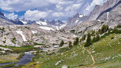
This photo shows hikers inching their way to the 13,000 foot top of Forrester Pass in California.  It actually looks like mountain climbing to me, not just hiking.  One video I watched did feature a description of a hiker losing her footing and starting to slide, luckily self-rescuing herself immediately but having to hang on desperately until rescued properly by two companions.  The PCT is also subject to closures due to forest fires, necessitating detours of some distance sometimes.  

I hope these descriptions give you some sense of what's involved in hiking these trails.  Even though my hiking days are over I find myself fascinated learning about them!

There are of course long-distance trails elsewhere in the world, but there are only two I've watched videos of.

The Camino de Santiago, a famous trail across northern Spain is really a network of pilgrimage pathways as old as 1000 years leading to the shrine of Saint James in the great cathedral of Santiago de compostella.  The most popular route, from the nearest corner of France, is about 500 miles or 800 km. long.  A Canadian from Thunder Bay walked this pilgrimage in 2018 and her videos are all posted on YouTube under the name Samantha Plavins.

The Tour de Mont Blanc is a circular route, and a much more scenic route, in the mountains of Switzerland, France and Austria.  Spectacular scenery but only 110 miles in comparison to the above trails.  It encircles the Mont Blanc massif, a group of 11 peaks over 13000 feet, the highest being Mont Blanc itself, the highest peak in western Europe.

Our own Bruce Trail here in southern Ontario, at about 900 km. in length, is hiked every year by 'End-to-Enders', but rarely as a thru-hike.  It is not really set up well with either shelters or camping sites.

If you want to see what the features of the Appalachian Trail are as an example, I've just watched a terrific video compiled by Taylor the Nahamsha Hiker, entitled 'All the Best Spots', the landmarks of the trail that appealed to her.  Taylor, who runs a gift shop in New Hampshire called 'Nahamsha gifts', is a bright enthusiastic young woman who hiked the AT in 2021 in only 120 days - that's fast!

It's a fun video to watch giving you a hiker's perspective on this trail.

I should say that I never intended to imply that you might be interested in watching well over 100 videos of someone hiking the AT from end to end!  But remember I'm forced to lie in bed awake for an hour or two every night, and I learn a heck of a lot more from these videos than from Facebook!  And also remember that as long as I keep my brain occupied I don't notice the chronic pain.


Monday, February 28, 2022

Hiking Videos

At some point in the distant past I posted about the hiking videos I watch.  My watching has expanded considerably since then, so I thought I'd give you an update.

My evening caregivers usually arrive by 8.30, so I'm into bed by 9 -  but I don't usually nod off until 11, in time to get my 8 hours.  So I've got an hour and a half or more to keep occupied while lying flat on my back and I've got into the habit of watching hiking videos on my phone.  That works better for me than trying to read.
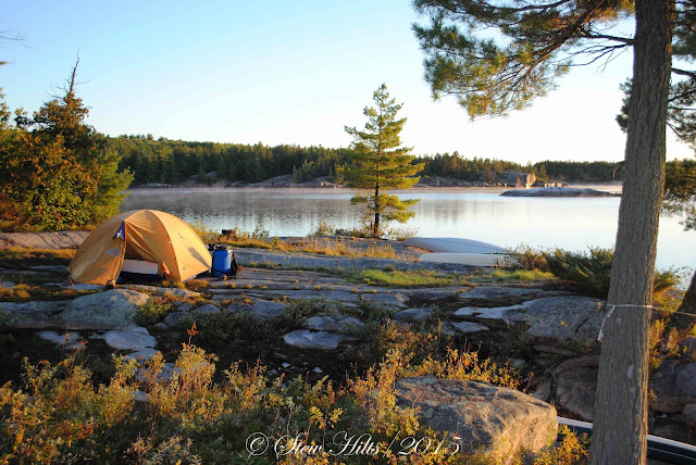
Camp among the pines

I've never hiked a huge long distance trail like these backpackers; most of my memorable trips were canoeing trips.  So I'm going to illustrate this post, which would otherwise have no pictures, with pix from a canoe trip in 2010 on the French River in northern Ontario, going east from Hwy. 69.
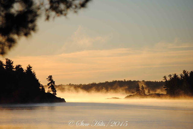
Sunrise

I believe the last time I wrote about this I referred you to Abbie Barnes, in the UK.  She's posted a lot of videos of trails in England.  All of the people I mention below can be found simply by searching under YouTube,  I'll refer to them by their UTube handle to make it easy to search for them.

Time for morning coffee!

So over the past few months I have followed five long-distance hikers, three on the Appalachian Trail (AT) and two on the Pacific Crest Trail (PCT).  Here they are:

Kelly Hays Hikes - Kelly has just finished posting the videos of her AT hike, generally one/per day for 183 videos.   That can keep me watching for a long time!  Kelly is planning to hike the PCT this year, starting soon.

MeanderingMeganB also just posted her final video, though both of these young women finished their actual AT hikes back in October.  Megan took 231 days to finish.

Taylor the Nahamsha Hiker was considerably faster, starting earlier and finishing last May in only 121 days.  She kept up posting videos daily as she hiked, unlike Kelly and Megan who finished off posting videos after they got home.  She's from New Hampshire - get it?
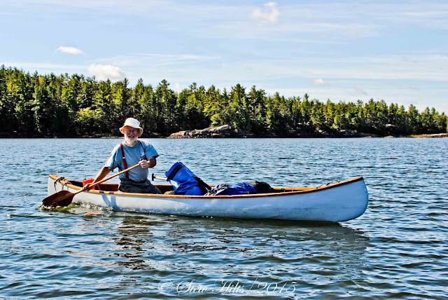
Yep, that's me, day pack open in front of me and big pack waiting for the next portage.

Becca Little Skittle posted 33 videos covering her hike of the PCT in 2019, often covering several days hiking in one video.  Because she posted those videos in 2019 I didn't have to wait for any videos to appear.  She is proposing to hike the Continental Divide Trail (CDT) this year.  The AT, PCT and CDT make up the 'Triple Crown' of long distance hiking in the USA.

Mary Mansfield, a UK hiker who flew to the States to hike the PCT in 2019 has posted 190 videos documenting that hike.  I'm still watching those and hoping she'll finish before it gets too cold (she finished in October 2019), but of course I know she will, since the videos are all up there already for me to watch whenever I like.  I like her style, so those are a favourite of mine, and she's still posting walking videos back in the UK.
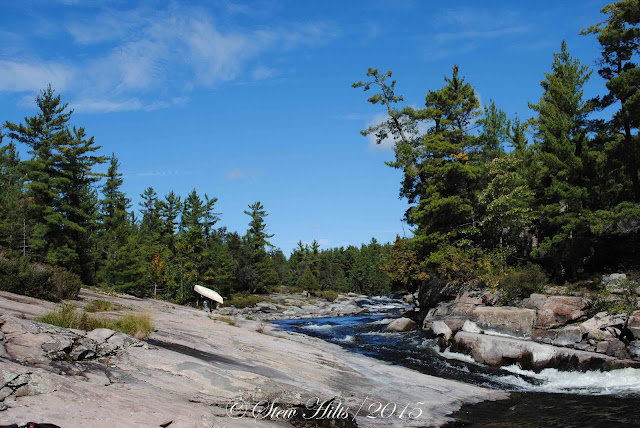
Time to portage

I'm now moving on to choose a new group of hikers to follow during 2022.  Hikers start on the AT as early as January, though the bulk start in March or April.  Since a hiker who goes by 'Dixie' posted her videos on her UTube channel 'Homemade Wanderlust' several years ago, posting videos has apparently become the thing to do.  So I have well over a dozen hikers to choose from and it's still only February.  It still gets pretty cold in the mountains of western Georgia in late February!  A Texas group were amazed at the sight of icicles!
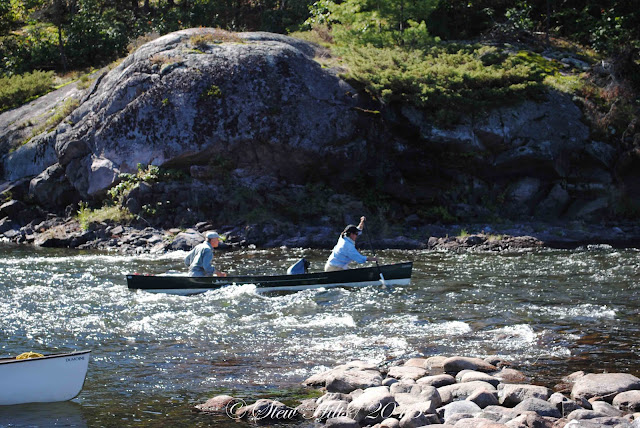
A little whitewater

There are several things I look for in choosing a hiker to follow.  I do like to follow 2 or 3 hikers for the whole trail rather than sampling 10 or 20 for little bits of the trail.  I first look for varied camera views, some selfie style, featuring the hiker talking to the camera. some views of the trail ahead as you hike,  and the valleys below, and some close-ups of interesting things like bugs, frogs  fungi and plants.

I also look for good audio quality (which requires a good wind-dampening microphone), and some info about where along the trail the video was taken (videos are often posted a week or two late once hikers get to a town where they can find wifi).  The best might actually have a map or elevation diagram - there's a lot of up and down on the trail.  And I guess I look for a friendly enthusiastic attitude.
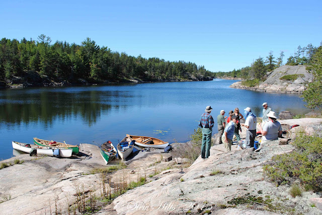
A consultation - after lunch?

So based on that, here's a list of hikers I'm currently sampling to pick a few I'll probably follow this year.

Em's Outdoors is posted by a Canadian hiker, short videos but good style.

KNA Outdoors is an older mom with a quiet style, but she's well on her way already.

Crunch hikes is a young couple who are hiking together and sound enthusiastic.

The Gallivanting Hikers are an older couple hiking the trail together.

Travelling with Tonya is a single woman who is hiking with her small dog.

Trekking along is a family of 3 girls and their mom, posting a video once a week.

Hiking with Nat is a mom and daughter hiking together.
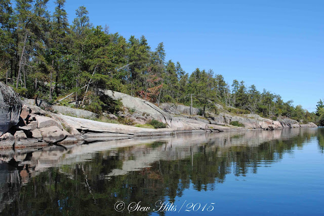
Reflections

And that's probably enough for now.  I'll be following Kelly Hays on the PCT and Becca Little Skittle on the CDT as well.  And there's one other UK hiker I'd like to mention.  Athena Mellor lived in the Peak district and actually wrote a guidebook for hiking there, then moved up close to the Lake District.  She and her partner have recently had a baby, Aife, but they're determined to keep up the hiking.  Their style and content has changed a little, but excellent photography and commentary.  I really enjoy Athena's videos.

That's all for now!


Saturday, February 26, 2022

The Shed Roof Weather Report

I'm pleased to bring you my first (and hopefully only) shed roof weather report, based on the two shed rooftops that sit in my immediate line of vision out the window.  You can tell how desperate I am for a blog post topic!  It at least illustrates how changeable the weather here in Grey County is in February!

There are two sheds shown in all the pairs of photos below, the first is our own, and the second is our neighbour's, though it's in the back corner of their lot, so it's right outside our window.  Note also that 'our own shed, the greener one, has a 45° roofline, which provides a bunch of storage space up under the roof, but creates a different angle for the sun hitting the shed roof.  

Both sheds are oriented differently as well.  The roof on our own is close to a right-angle from the mid-day winter sun, but the neighbour's is at a low angle, and only in late afternoon,  Although both shed doors are facing southeast, the rooftop on our shed also faces southeast while that on our neighbour's faces southwest.  Figure all that out if you can!

Starting on Feb. 12th, we certainly had winter weather here, as you can see.  And it was quite windy that day, the direction of the wind showing up in the pattern on the neighbour's shed roof.

By 5 o'clock the sun had melted most of the snow on our shed roof, but not on our neighbour's.  The light-coloured icicles on the left of our shed were lit up in the late afternoon sun.

You can't say much about the weather on the morning of Valentine's Day, just snow on both rooftops.

But by 5 o'clock that afternoon the sun had conquered our roof, and melted the edges around our neighbour's.  The different angle of the sheds and their rooftops made the difference.  The sun was shining nicely that day.

A few days later we had an almost snow-free rooftop day, just a little on the neighbor's.  There was certainly lots of snow on the ground still though!


But a few days later winter was back - that's what it's been like this February.

The difference that afternoon was striking, showing the difference in the angle of the two sheds to the sun.  On the neighbour's shed it wasn't warm enough to melt the snow, but it was warm enough to form icicles.  And how do you suppose those icicles develop a curve as they grow?  Is the prevailing wind enough to do that?

And I refuse to comment further on our shed rooftops yesterday, after our most recent dump of snow!  They were both supposed to be bare by now!

Looking ahead at the long term 14 day forecast is at least a little encouraging.  While the coming week features temperatures only as high as freezing during the day, and down to -16°C at night, temperatures the following week drop only to -6° at night and stay at or close to freezing during the day.  However, sunshine can moderate those forecasts, as we all know.  Daytime sunshine can easily push temperatures above those forecast, while melting snow on driveways, rooftops and roads.  Here's hoping.  Certainly the norm in early March here would be an increase in sunny days.


Tuesday, February 22, 2022

William, 1977 - 2015

As you'll know if you've read this blog for long, William, our oldest son passed away in 2015 while flying over a wildfire near Cold Lake in Northern Alberta.  He was doing what he loved, flying a water bomber and fighting forest fires.  The investigation found that a 'fire tornado', a rare side-effect of forest fires, downed the plane.

This is one of my favourite photos of him, taken by a girlfriend at the time, Sandra Muench.  I like his smile.

It took Will 14 years of flying to gain the skills to become a water bomber pilot with Conair, Canada's largest aerial fire-fighting company.  From northern Ontario to the North-west Territories, to the west coast, with a few other places like Fiji thrown in for good measure, Will had an exciting and challenging career mostly flying float planes.  He died doing what he loved, and we're so proud of him.

I find myself thinking about Will more as the years go by, mainly thinking how lucky he was to have successfully followed his dream and achieved his goal.  I think few people receive that gift.  And our memories are entirely positive now, blessed to have have had him for the too-short 38 years he lived.

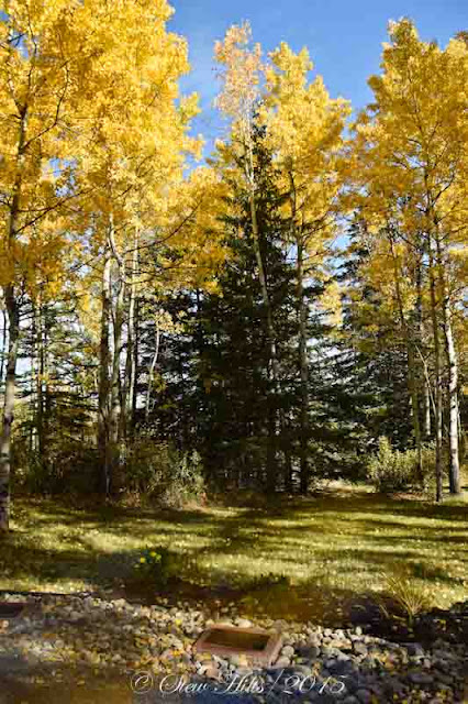
The official memorial service was in Hinton Alberta, at the Hinton Training Centre.  The memorial is located out in the grounds of the centre, under some golden Aspen trees in a very peaceful setting.  It's one of my favourite memories of that year.

William's plaque.

Rest in peace Will.

Saturday, February 19, 2022

Four Years Paralyzed

It was four years ago a few days back that I went into hospital for surgery to replace the upper loop of my aorta with a teflon aorta.  Ten years earlier I had suffered an 'aortic dissection', a tear in the inner lining of the aorta (that healed itself after a great deal of pain).  I was later told survival was usually about 5 years, so I was doing well. 

The aftereffect was the slow development of an aortic aneurysm, a large swelling of the aorta.  The danger was that this would rupture and I would be dead in seconds.  So the teflon aorta was by way of preventive surgery to keep me alive.  Since there was beginning to be a big risk I would die anyway, it seemed worth taking the risk of surgery.

As they say, this was a case where the surgery went well, but the patient (almost) died.

But I survived, and lay in the ICU bed for 10 weeks very slowly regaining consciousness.  I knew from the beginning that I would be paralyzed, but we didn't know what other side-effects there might be.  You can imagine how stressed Mrs. F.G. was during these weeks, not knowing if I would even survive, but she was always there, being my advocate, keeping me alive (she turned down two offers to 'let me go peacefully'). and always greeting me with her radiant smile.  That's what kept me going.

It's now been four years since those days, and I ask myself how far we've come, what's good and what's bad.  To be honest I don't think you would believe all that had happened four years ago if you saw us today.  We have learned to live with this monster, and are making the best of it.  Even in the middle of winter I'm ok, staying indoors, reading and writing.

I think on balance Mrs. F.G. is the one paying the price.  We've come to a point where things are stable, but there's no doubt that she has given her life to keep me going.  I can't say enough for the depth of her love.  

And I think I'm actually still improving, I certainly feel that I am.  The routines have become more familiar, and the caregiving more dependable.  I keep picking up little bits of responsibility, though they're so trivial it doesn't feel like much of a contribution.  I have steadily improved at physio, making a big leap upwards (literally) when I managed late last fall to pull myself up into a standing position without anyone lifting me.  

Here at home some furniture and room re-arranging means that Mrs. F.G. can get away from me, and I have an 'office' corner in the bedroom where I can sit in a sunny window every morning (if there's sun).  I'm sitting here now as i write this, and I've developed a range of things to be working on during the too-long winter months.

I think the biggest difference for me personally is that I've given up on riding the nearby roads full of 'alligator pavement' and found smooth routes downtown.  I'm now very comfortable riding downtown by myself during the summer months, often picking up a coffee and going down to sit by the harbour.  The library is an important destination for me too, and our coffee group continues to meet year-round when lockdowns allow.

So I guess I'd say that we're doing surprisingly well.  I've a couple of goals for the coming year but I'll tell you about those if they happen.  Cheers for now!


Wednesday, February 16, 2022

Keefer Creek


Having told you in my last post that probably not many who drive Hwy. 26 know about Keefer Falls, or recognize Keefer Creek valley, or even the creek itself, I thought I'd better fill you in a bit you so any local readers will have no excuse in the future!  I've pulled a variety of photos from the past to put this together.

Although this is 3 years old, it could have been yesterday, the valley looks the same today.  We're looking west here, a few miles west of Woodford, and a short distance east of the airport.  For anyone driving the highway the valley is very obvious.

The same view in summer looks like this.

The tiny streams this high up in the watershed are most easily seen during spring runoff, when there's a bit of snow still on the ground.  This is one of three that drains under the highway coming from further up in the valley.

Then the stream continues on the north side of the highway on its way to Georgian Bay (eventually).  This stream joins with Keefer Creek itself just beyond this photo. 

Upstream of these tiny streams, above the slope of the valley we went exploring once and found Keefer Creek Farm.  This appears to be where the creek originates.

An air photo of the main spring where Keefer Creek originates in the front fields of Keefer Creek Farm.  (From google Maps).

Where it passes under the sideroad (Concession Rd. 5N) the stream is backed up a little and looks larger than it really is at this point.  Lots of flowers along the creekbank when we were there.

There is also a sinkhole that feeds into Keefer Creek, about a mile and a half west of this point.  However I've never got a good picture.  A local reader told me about it, and I've watched it as we drive by, but I don't know if anyone knows where the underground flow joins the main creek.  I'll keep trying to get a good picture.

Take a jump several miles in the other direction downstream and the creek is flowing like mad in the early spring, heading for Keefer Falls and the site of the old mill.
 t
It comes to an abrupt drop and plunges over Keefer Falls, site of an old mill.  Note the icicles under the edge of the rock on the right - this was very early spring.

The bedrock it's dropping over here is not the Amabel Formation of the upper escarpment but the Manitoulin Formation, a lower geological layer.  It's composed of many thin layers of dolostone, as shown in this photo, and is the cause of many waterfalls along the Bruce Trail.


The foundations of the old mill can still be seen, right beside the falls.

**************
And two of you got the answer to yesterday's mystery question, the strange white, pink, blue and green pattern with little bubbles in it.  It's the psychedelic pattern of soap sprayed on our car windows when we go through the car wash.  I have nothing to do but sit there and watch the windows!

As you can see Blogger didn't help me with this post.  It's stuck in the 'centre all text' mode.  Sorry about that, it's not my usual style.